West London Tram
Acton Detail
Some graphics
We present the following
to help TfL diseminate its information. We wish to make the information
available for informed comment to cyclists and other concerned persons.
Ealing Detail
Shepherds Bush Detail
Cross-sections
These come from Drawings
No. 8012BG05/A2 sheets A and B and dated 07/ 01/ 03.
You are looking east along the Uxbridge rd.
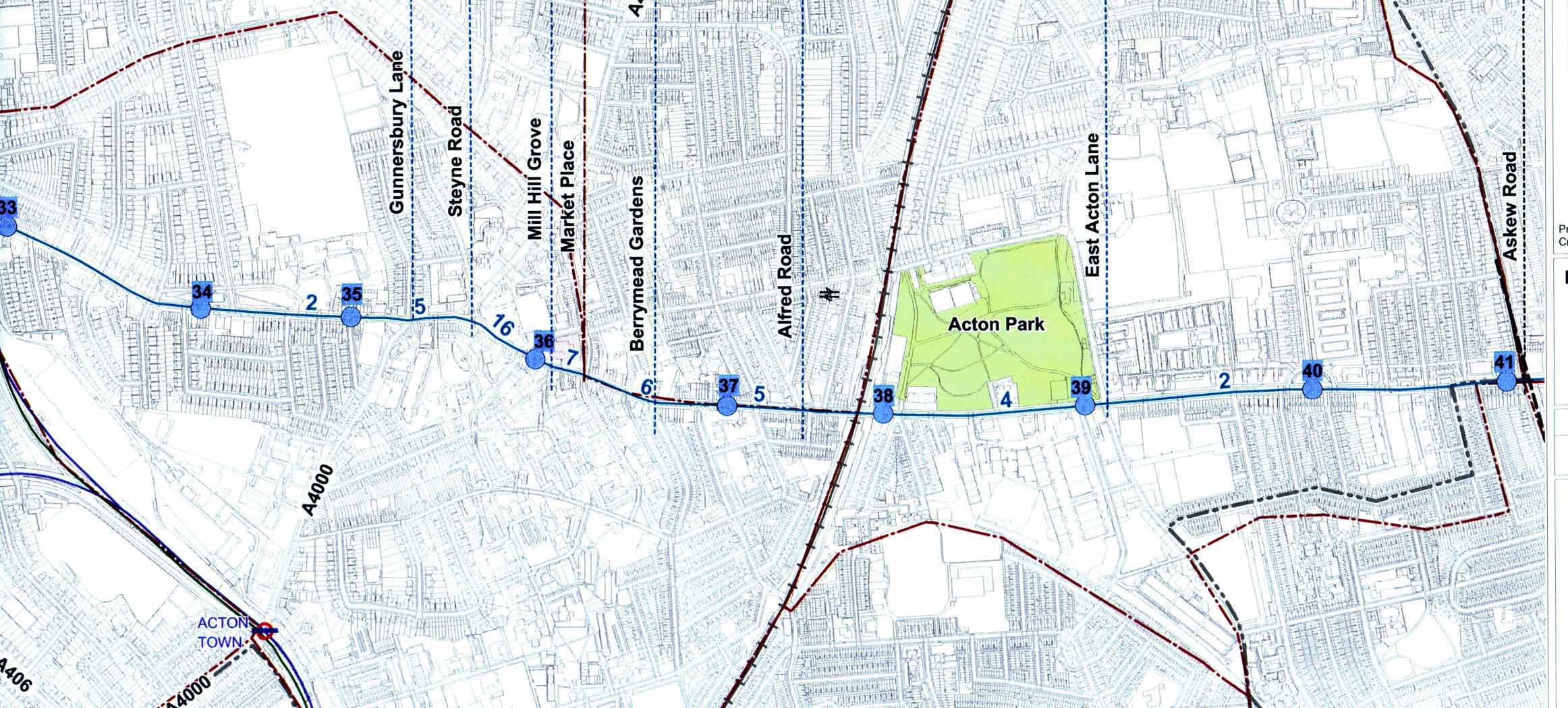
Detail of route
These graphics have been scanned from plans produced for Transport for London, London Trams. They are known as level 2 plans / issue 3.
The drawing No. is D101169 / S207 and it is dated 13/02/03. The original plans have the logos of Scott Wilson and Aegis Semaly Ltd on them.
These level 2 plans are in the public domain. There are also level 1 plans. Those are not in the public domain and it is not known what they show.
The blue numbers along the route refer to the cross-section type.
The black numbers on a blue square refer to the number of the nearby tramstop shown by a blue circle.
To reduce file size and download time, low resolution scans have been used and so they lack the clarity of the originals.
Cross-sections
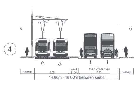
Cross-
section 4
North Common rd
to
Warwick rd
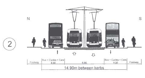
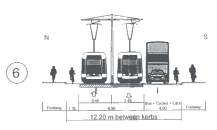
Cross-
section 2
Warwick
rd
to
Gunnersbury
Lane
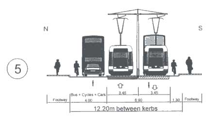
Cross-
section 5
Gunnersbury
Lane
to
Steyne rd
Cross-
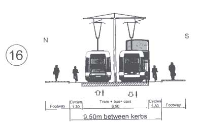
section 16
Steyne
rd
to
Mill Hill grove
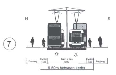
Cross-
section 7
Mill
Hill grove
to
Market Place
Cross-
section 6
Market
Place
to
Berrymead Gdns
Cross-
section 5
Berrymead
Gdns
to
Alfred rd
Cross-
section 4
Alfred
rd
to
East Acton lane
Cross-
section 2
East
Acton lane
to
Askew rd
Detail of route
The image below may take a short while to load
John Griffiths [co-ordinator
hfcyclists]
020 7371 1290
07789 095 748
john@truefeelings.com
our website www.hfcyclists.org.uk